Antananarivo: ten places and excursions
Discover ten stops in Antananarivo and its surroundings: Rova, Andohalo, Analakely, lakes and Highland landscapes.
The Rova
Hery Zo Rakotondramanana — CC BY-SA 2.0 · Wikimedia Commons
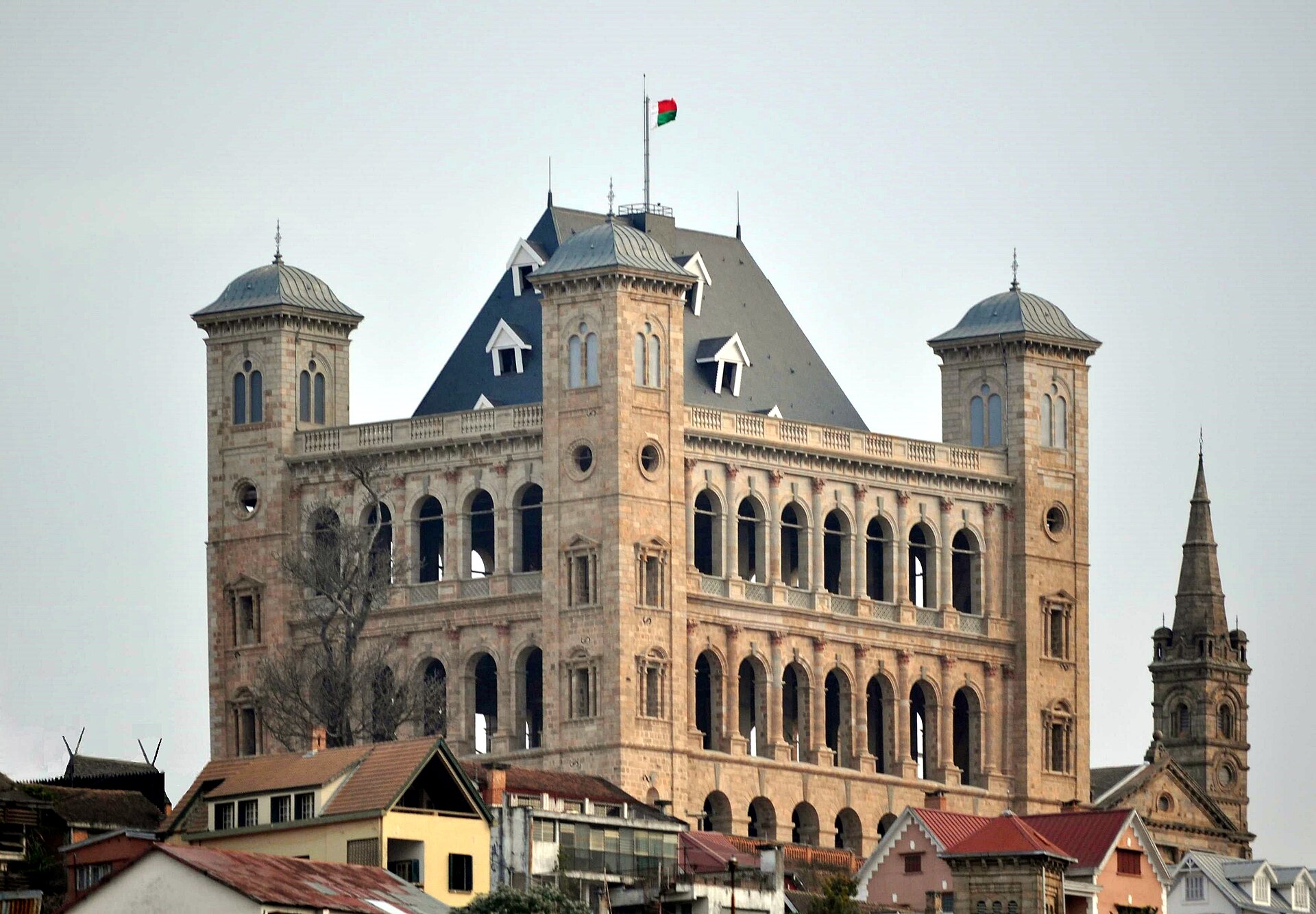
The journey begins on Analamanga hill. Manjakamiadana Palace rises above brick houses, stairways and the plains around the capital. From the Rova, Tana reveals its shape: daily life below, and royal history on the heights.
- Explore the royal enclosure and Manjakamiadana Palace.
- Look across the rooftops and rice fields from the viewpoints.
- Walk down towards Andohalo through the Upper Town.
Wear comfortable shoes for hills and cobblestones. Check access to the buildings on site.
- Duration
- 1–2 hours
- Distance
- In Tana
See this stop in 3D ↗Tourism source
Andohalo
HoneyGaLe — CC BY-SA 3.0 · Wikimedia Commons
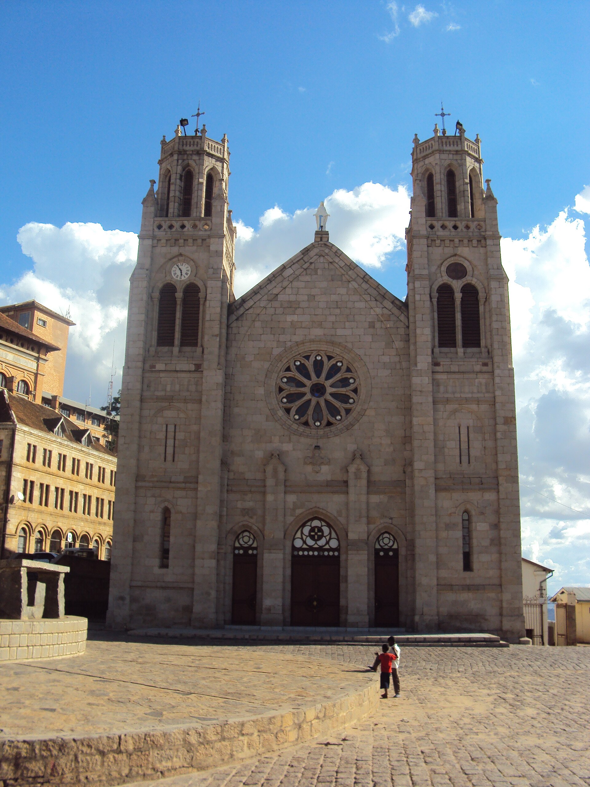
A short walk from the Rova, Andohalo invites you to slow down. The cathedral’s twin towers, old houses and sloping passages form a neighbourhood best explored on foot. Between façades, streets open onto views of the city below.
- Look at the façade of the Cathedral of the Immaculate Conception.
- Walk around the square and neighbouring streets.
- Explore stairways and viewpoints towards the Lower Town.
The cathedral is a place of worship. Respect services and ask before photographing inside.
- Duration
- 45 minutes–1½ hours
- Distance
- In Tana
See this stop in 3D ↗Tourism source
Lake Anosy
Sascha Grabow www.saschagrabow.com — CC BY-SA 3.0 · Wikimedia Commons
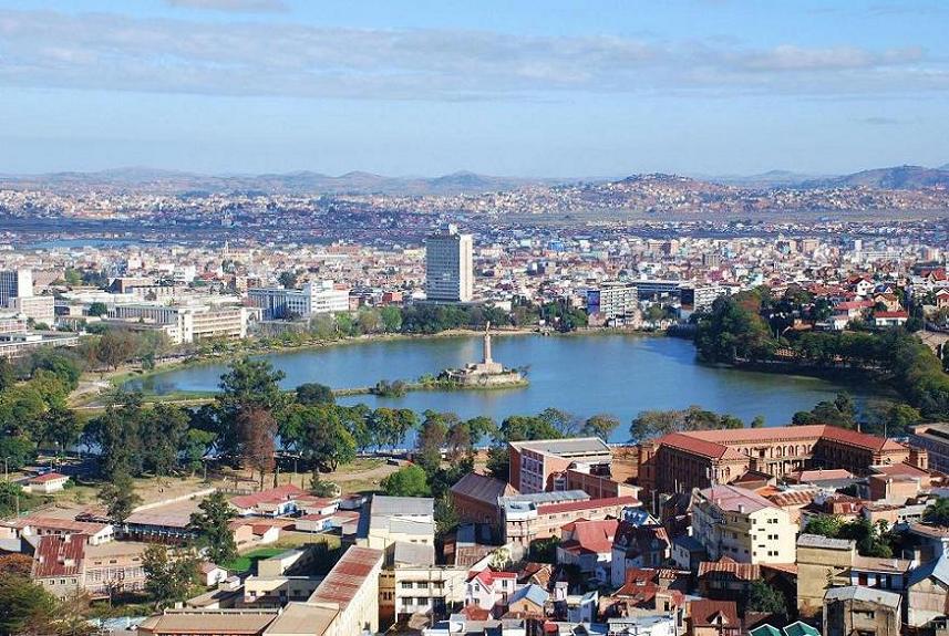
Anosy is an open space in the urban landscape. A small island linked to the shore carries the war memorial and its golden figure. Houses climb the neighbouring hills: the lake is a clear reference point for understanding Tana’s geography.
- Look towards the island and memorial from accessible shores.
- Photograph the lake with the Upper Town behind it.
- Continue towards Mahamasina or the historic neighbourhoods.
The lake’s outline follows map data. Island access and shore paths depend on what is open on your visit.
- Duration
- 30–45 minutes
- Distance
- In Tana
See this stop in 3D ↗Tourism source
Analakely
Cactus0625 — CC BY-SA 4.0 · Wikimedia Commons
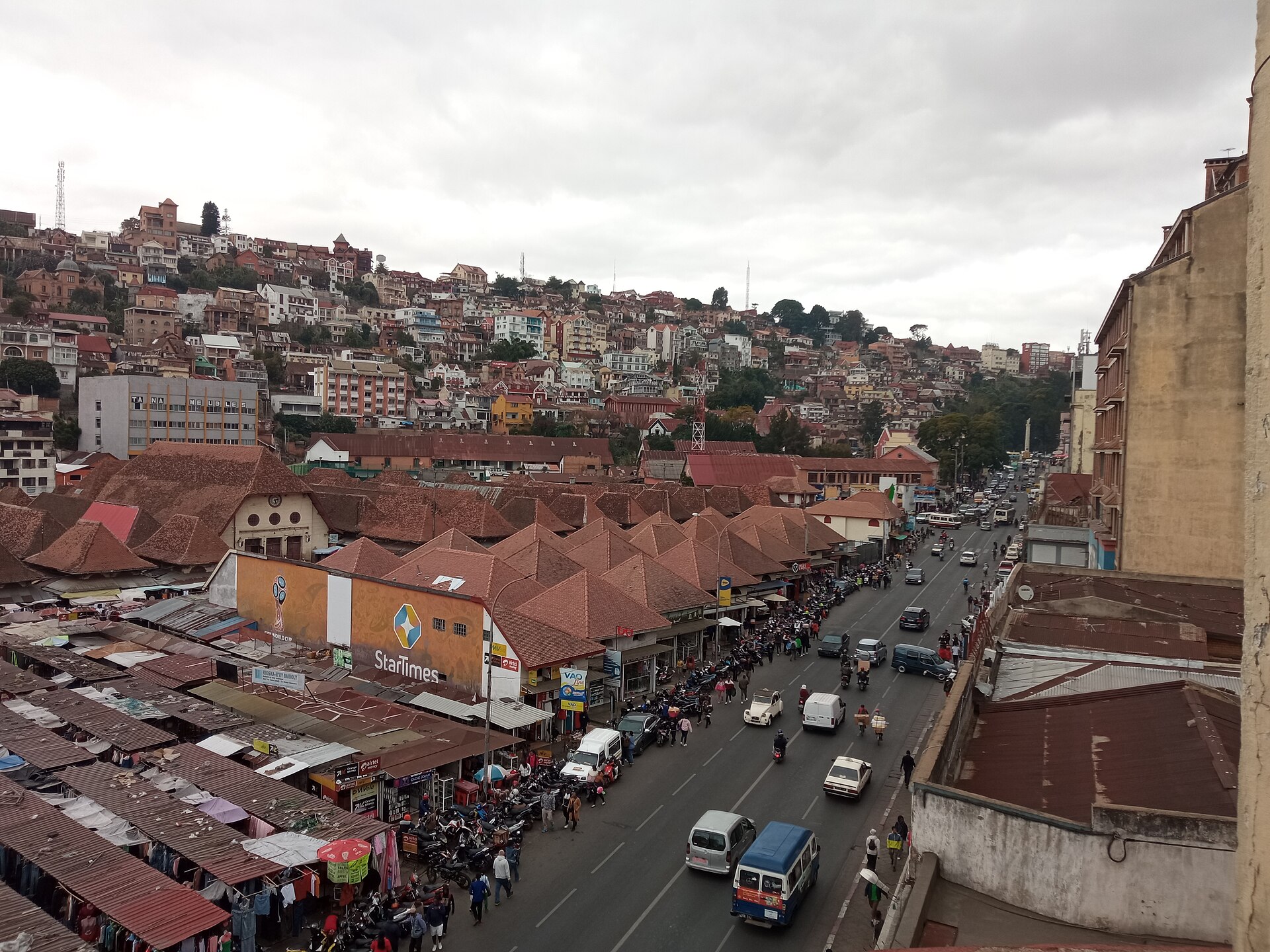
After the hills comes the energy of the Lower Town. Stalls, shops and pedestrian passages around Analakely’s pavilions give the visit another rhythm. Avenue de l’Indépendance extends the walk north towards Soarano.
- Explore the market pavilions and small shops.
- Browse textiles, everyday goods and crafts at the stalls.
- Walk along Avenue de l’Indépendance towards the station.
Ask before photographing people or their stalls. A local guide can help you discover the streets and products.
- Duration
- 1–2 hours
- Distance
- In Tana
See this stop in 3D ↗Tourism source
Soarano station
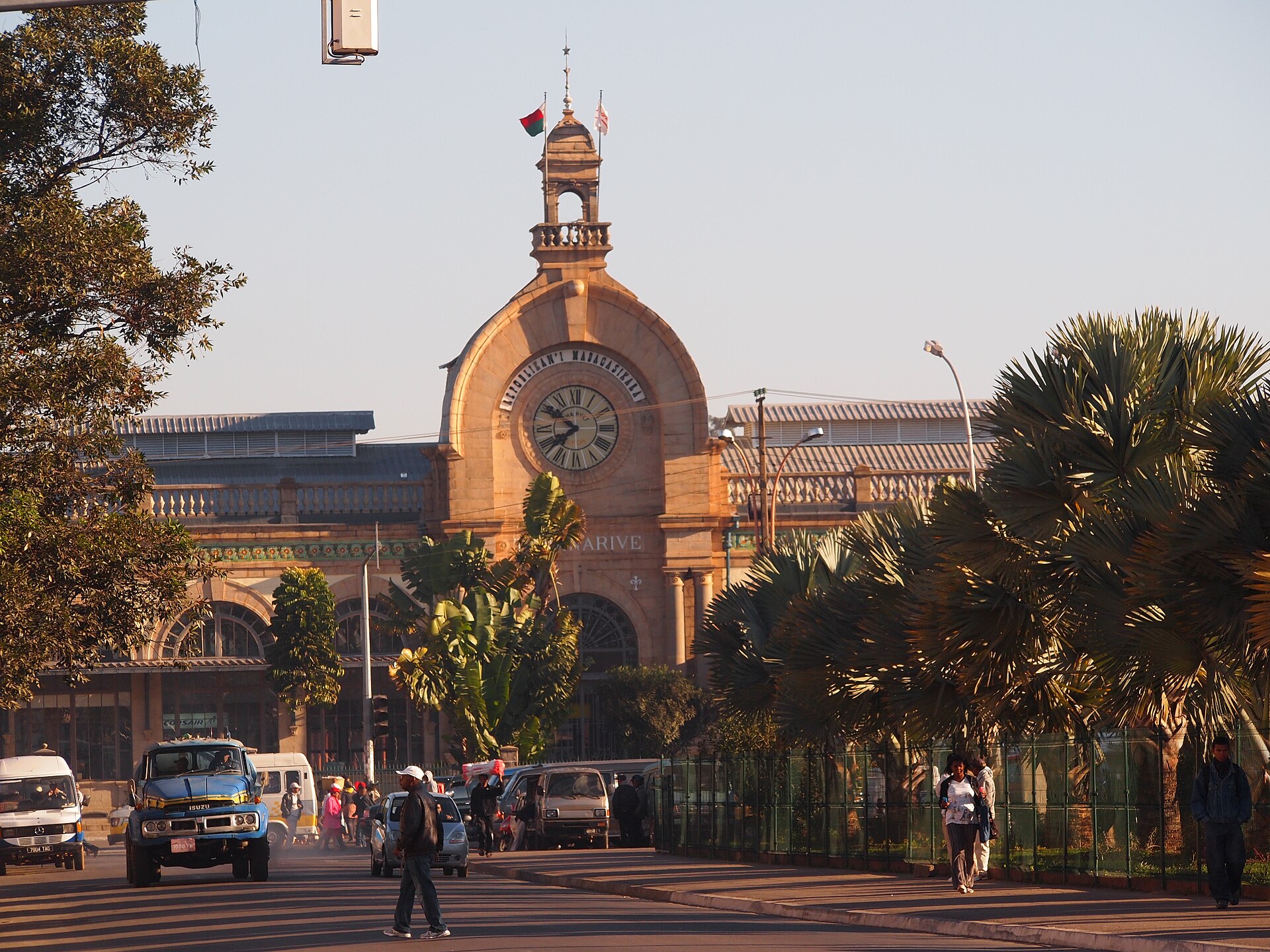
Lemurbaby — CC BY-SA 3.0 · Wikimedia Commons
Soarano closes the perspective of Avenue de l’Indépendance. Its clock, façade and long wings evoke the development of the Lower Town in the early twentieth century. A short architectural stop that naturally follows Analakely.
- Study the façade and clock from the forecourt.
- Look down the avenue towards the centre.
- Explore publicly accessible spaces in the building.
The station is shown for its architecture. Contact the rail operator if you wish to travel by train.
- Duration
- 30–45 minutes
- Distance
- In Tana
See this stop in 3D ↗Tourism source
Tsimbazaza
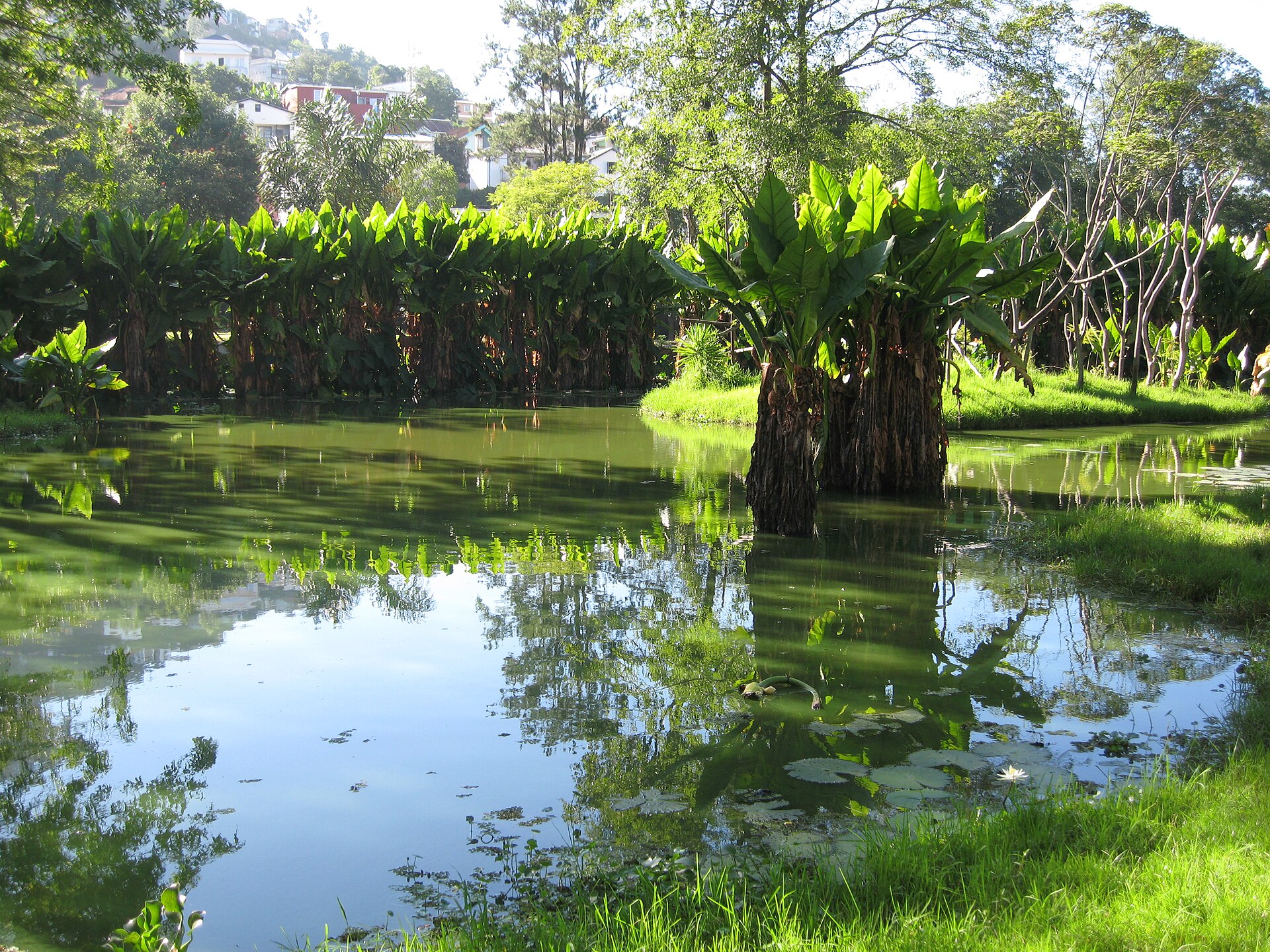
Woodlouse from Brighton, UK — CC BY-SA 2.0 · Wikimedia Commons
South of the historic neighbourhoods, Tsimbazaza combines botanical and zoological collections. Ponds, tall trees and paths offer a first encounter with Malagasy flora and fauna without leaving the capital. A place for a slower walk.
- Walk among the trees and ponds.
- Discover the accessible botanical and zoological collections.
- Take time to observe, especially with children.
Open spaces and visible animals may vary. Check the park’s information on site.
- Duration
- 1½–2 hours
- Distance
- Southern Tana
See this stop in 3D ↗Tourism source
Ambohimanga
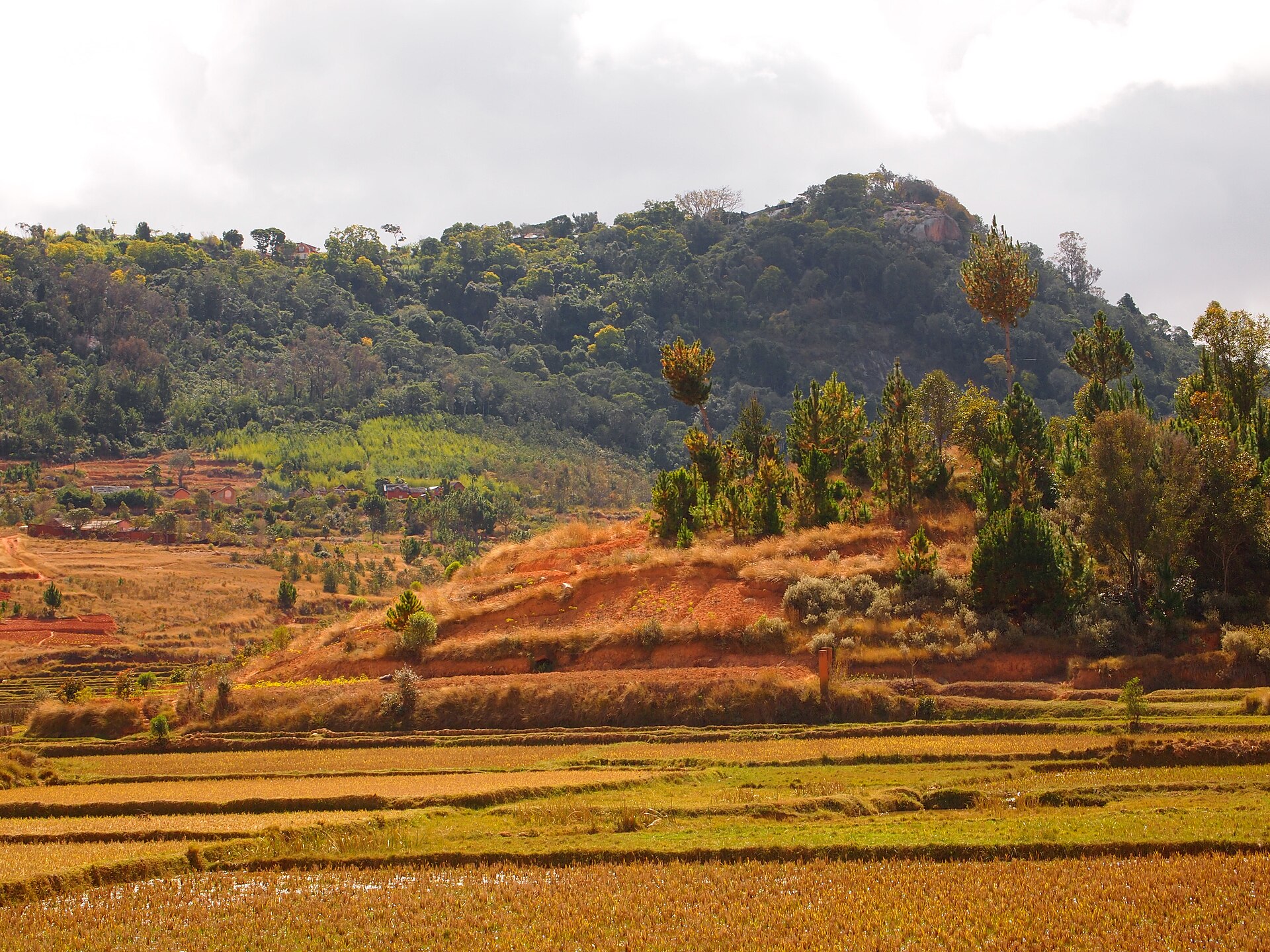
Lemurbaby — CC BY-SA 3.0 · Wikimedia Commons
North of Tana, Ambohimanga preserves a royal city, burial sites and a sacred landscape. Walls, gates, royal houses and trees create an intimate place with a living cultural importance. It has been a UNESCO World Heritage site since 2001.
- Visit the royal enclosure with a guide.
- Look at the gates, royal houses and traditional structures.
- View the rice fields and villages from the hill.
This remains a sacred place. Follow the guide’s instructions and respect ritual spaces.
- Duration
- Half a day
- Distance
- North · roughly 25 km by road
See this stop in 3D ↗Tourism source
Lemurs’ Park

Hiroki Ogawa — CC BY 3.0 · Wikimedia Commons
On the RN1, about 25 kilometres from central Tana, Lemurs’ Park combines a lemur reserve and a botanical park. A guided visit introduces several species and the park’s work. The Katsaoka River and vegetation give this stop a different atmosphere.
- Join a guided visit to observe the lemurs.
- Discover the plants and Katsaoka River landscape.
- Allow time for a break before returning to Tana.
Animal positions and behaviour cannot be guaranteed. Keep your distance and follow the guide.
- Duration
- Half a day including travel
- Distance
- West · roughly 25 km by road
See this stop in 3D ↗Tourism source
Mantasoa
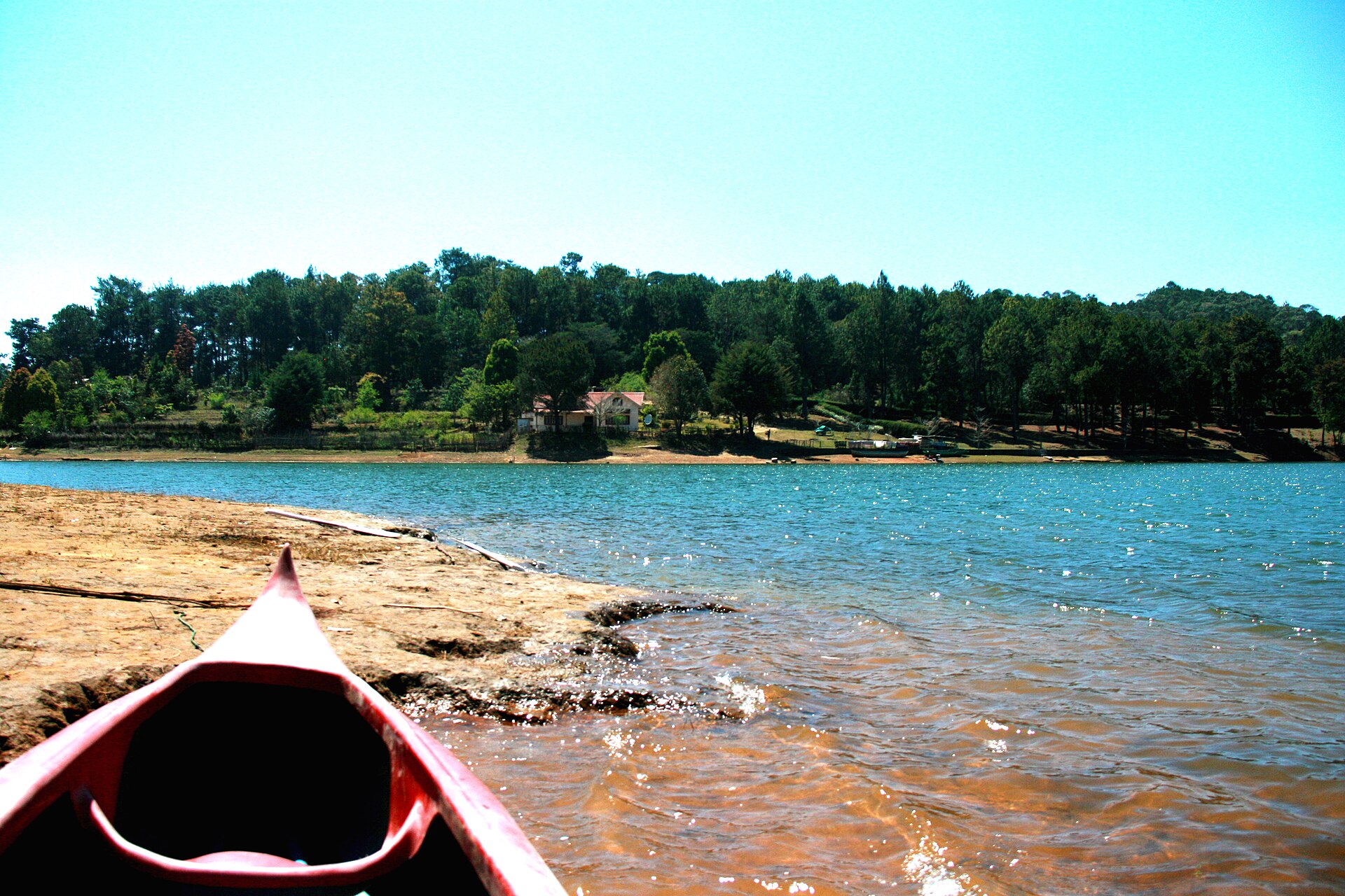
Mickaël Andriantsoa RAKOTONDRABE — CC BY-SA 4.0 · Wikimedia Commons
East of the capital, Mantasoa changes the pace. The reservoir follows branching valleys, wooded hills surround the water, and accessible shores invite a day outdoors. The village also preserves traces of Jean Laborde’s nineteenth-century industrial complex.
- Walk along accessible lake shores.
- Arrange a boat trip with a local operator.
- Discover the sites associated with Jean Laborde.
Shore access and water activities depend on local operators. Travel times vary with traffic.
- Duration
- A day, or an overnight stay
- Distance
- East · roughly 70 km by road
See this stop in 3D ↗Tourism source
Ampefy & Itasy
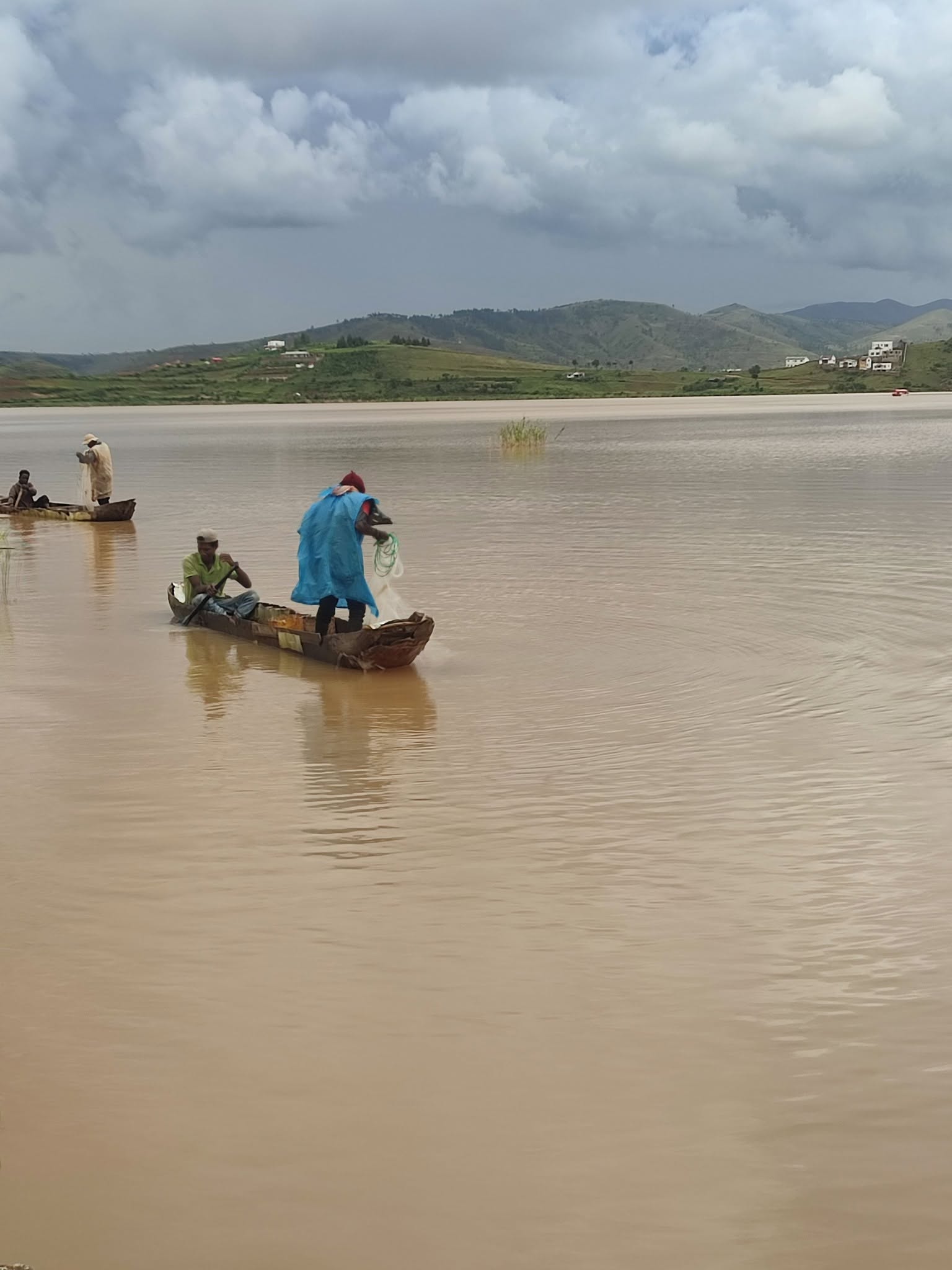
Mammysou17 — CC0 · Wikimedia Commons
Beyond the rice fields and villages along the RN1, Ampefy opens onto Lake Itasy and volcanic hills. Lily Falls and the Analavory geysers add separate excursions. The last stop is far enough from Tana to reward a slower stay.
- Enjoy viewpoints and walks around Lake Itasy.
- Visit Lily Falls with local guidance.
- Plan the Analavory geysers as a separate trip.
The map marks Ampefy. Lily Falls and the geysers are separate sites, with travel between them.
- Duration
- Two days recommended
- Distance
- West · roughly 120 km by road
See this stop in 3D ↗Tourism source


